
Social Media
Indian & European Union’s Earth Observation Satellites Data Sharing for Economic Development
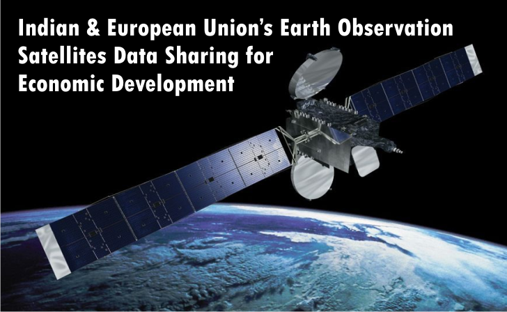
Copernicus – European Union’s Earth Observation and Monitoring Programme and Indian fleet of Remote Sensing Satellites will now be sharing Earth Observation Satellite Data to allow the benefits to extend beyond the borders of the partners, as per a landmark Cooperation Arrangement signed on March 19, 2018 at Bengaluru between European Commission (EC) and India’s Department of Space (DOS), with the aim to strengthen and stimulate cooperation on Earth observation and mutual access to the data from the European Union’s Sentinel series of satellites and from the Indian Earth observation satellites.
According to Philippe Brunet, Director for Space Policy, Copernicus and Defence, Copernicus programme has also signed in March 2018 Cooperation Arrangements with Brazil, Chile and Colombia besides India, following those already in place with the United States and Australia, now one-third of the world’s population has privileged access through high bandwidth connections to Copernicus free and open data and information. These agreements are important because Earth Observation open data has become a tool of economic development which can benefit EU and partner countries businesses and entrepreneurs through increased collaboration and partnerships
Copernicus, previously known as GMES (Global Monitoring for Environment and Security), provides a wide range of applications, e.g. climate change, land, ocean and atmosphere monitoring as well as support in the forecasting, management and mitigation of natural disasters.
India has a developed ambitious and wide-ranging Earth Observation Programme which is managed by the Department of Space of India and implemented by the Indian Space Research Organisation (ISRO).
Under the Cooperation Arrangement:
- European Commission intends to provide India with free, full and open access to the data from the Copernicus Sentinel family of satellites using high bandwidth connections
- Indian DOS will provide the Copernicus programme and its participating states with a free, full and open access to the data from ISRO’s Earth observation satellites.
- ISRO’s satellite data will be made available for distribution on the ‘Copernicus hub’.
- This comprises land, ocean and atmospheric series of ISRO’s civilian satellites: Oceansat-2, Megha-Tropiques, Scatsat-1, SARAL, INSAT-3D, INSAT-3DR; with the exception of commercial high-resolution satellites data.
- The Cooperation Arrangement includes technical assistance for the establishment of high bandwidth connections with ISRO sites, in particular through setting up of mirror servers, data storage and archival facilities.
- ISRO will co-ordinate access to in situ data and promote the use of information and data provided by the Copernicus programme with various institutions and government agencies, particularly the environmental sector and all other users, including academia and the private sector.
- Copernicus services rely on data from in situ monitoring networks (e.g. ground based weather stations, ocean buoys and air quality monitoring networks) to provide robust integrated information and to calibrate and validate the data from satellites. The in situ networks are managed by Members States and international bodies and make data available to the services by agreement.
- This Cooperation Arrangement is also expected to lead to the development of an active downstream sector in the European Union and in India.
- The aim is at facilitating the involvement of diverse users in the development of products and services.
- They intend to encourage cooperation on data processing for common use in line with the EU-India Agenda for Action-2020, e.g. long-term management of natural resources, monitoring of 2 marine and coastal areas, water resource management, impacts of climate variability and climate change adaptation, disaster risk reduction, food security and rural development, infrastructure for territorial development and health management issues.
Copernicus provides a unified system through which vast amounts of data are fed into a range of thematic information services designed to benefit the environment, the way we live, humanitarian needs and support effective policy-making for a more sustainable future.
Copernicus, a leading provider of Earth observation data across the globe, already helps save lives at sea, improves our response to natural disasters such as earthquakes, forest fires or floods, and allows farmers to better manage their crops, collects data from Earth observation satellites and ground stations, airborne and sea-borne sensors. The benefits of the Copernicus programme extend globally.
European Commission’s Emergency Response Coordination Centre had activated Copernicus Emergency mapping service for damage extent delineation maps following the severe floods which affected the Indian State of Andhra Pradesh in October 2014 and after a tropical storm that affected the State of Odisha in 2013.
Copernicus processes data and provides users with reliable and up-to-date information through a set of services that fall into six main categories: Land Management, Marine Environment, Atmosphere, Emergency Response, Security and Climate Change. These services are operational and are enabled by the Earth observation data from the six Copernicus Sentinel satellites currently in orbit, as well as a number of contribution missions from other operators.
In essence, Copernicus will help shape the future of our planet for the benefit of all. European Space Agency (ESA) is contributing by providing a proven framework for the development of operational systems on behalf of the user community, paving the way for investment in future generation systems. ESA is exploiting its 30 years of expertise in space programme development and management to contribute to the success of Copernicus.
Related Articles
-
 Apr 26, 2017 12:08 pm






Related Articles
-
Created at: Jan 22, 2020
-

Created at: Nov 2, 2019
-

Created at: May 29, 2019
-

Created at: May 28, 2019
-

Created at: May 28, 2019
-
Created at: May 27, 2019
-

Created at: May 27, 2019